Facebook Spenden Dateien Impressum Facebook
Mobile Webseite Facebook Instagram Twitter Pinterest

Facebook
  Hauptseite
Hauptseite

Landkartenarchiv @ Facebook

Landkartenarchiv @ Instagram

Landkartenarchiv @ Twitter

Landkartenarchiv @ Pinterest

Impressum / Kontakt

Spenden für neue Projekte - Geld für fehlende teure Straßenkarten, Stadtpläne und topographische Landkarten

Dateien zuschicken - Neue Karten von Ihnen für das Landkartenarchiv.

Datenschutzerklärung

Weltkarten und Weltatlanten
Weltatlanten - 14 Weltatlanten (1730-1925).

Matthaeus Seutter (1730, 1740, 1744)
Homanns Erben (1788)
Geographisches Institut (1821, 1886)
Stieler s Hand-Atlanten (1833, 1851, 1860, 1881, 1891, 1911, 1925)

Historische Weltatlanten im Landkartenarchiv

Weltkarten - Die Postdampfschifflinienkarte des Weltpostverkehrs (1892), Ravenstein Weltkarte (1941)

; Weltkartenwerke - Internationale Weltkarte / International Maps of the World (1:1 Mio.,223 Karten, 1913-1980), ONC - Operational Navigation Chart (1:1 Mio., 271 Karten, Englisch, 1961-1980), Mir (1:500.000, 2.024 Karten, Russisch, 1947-1991 / 1:1 Mio., 254 Karten, Russisch, 1948-1991), TPC - Tactical Pilotage Chart (1:500.000, Englisch, 652 Karten, 1964-2000)

; 2. Weltkrieg - Esso War Map (1944)

Europakarten
Europakarten - 3 Europakarten (1916-1959). Reise- und Verkehrskarte (Opitz, 1916), DDAC Europakarte 1:5.000.000 (1940) , Europa - Mittelmeer, Afrika, Kleinasien 1:5.000.000 (Mai 1941) , DDAC Strassenkarte von Südost-Europa 1:2.000.000 (1942) , Ravenstein Übersichtskarte Europa 1:8.500.000 (1943) , Der Europäische Raum 1:6.000.000 (Mai 1943) , Esso West-Europa (Esso, 1956 und 1959).

Länder & Hauptstädte - Esso Danmark (Dänemark) (1958), Esso Italia (Italien) (1957), Esso Nederland (Niederlande) (1958), Esso Norge (Norwegen) (1956), Esso Sverige (Schweden) (1956), Esso Road Map London (1965)
Europa

Deutschlandweite Landkarten, Stadtpläne und Themenkarten
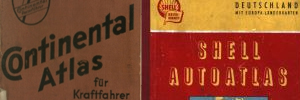
Autoatlanten - Atlas des Deutschen Reichs (1883) - Continental Atlas (1925, 1938), Dunlop Automobil-Strassenkarte (1927), Reichsautobahnatlas (1938), SHELL-Autoatlas (1950, 1954), Deutscher Generalatlas / Der gro e ADAC Generalatlas (1967, 1974, 1980, 1985), FALK Auto-Atlas (1973)

Autoatlanten von Deutschland

Deutschlandkarten - Von A-Z: Continental Autokarte (1934, 1948), BP-OLEX-Autokarte (~1937), BZ-Autokarte A (~1935, ~1938), 2. Weltkrieg: 1940, 1943, 1944). S dosten (1939, 1940), Osten (1943, 1944) DDAC Deutschland (1938, 1939, 1940, 1941). 1945-1990: ADAC Autobahnkarte (1950), ADAC Stassenkarte (1951, 1958, 1966, 1972), BV-Karte Westdeutschland (~1950), Esso Deutschland (1955, 1955), ADAC Strassenzustandskarte (1957), Shell Deutschland (1958), Off. Road Map Northern Germany (1959)
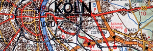
Straßenkarten - Ab 1900: Deutsche Straßenprofilkarte (7 Karten, 1930-1925), Ravenstein-Liebenow (11 Karten, 1900-1945). Ab 1918: ADAC Strassenkarte (3 Karte, -1939), BP-Olex Autokarte (12 Karten, -1939), B.V.-Karten (58 Karten, 1935-1939), B.Z.-Autokarte (65 Karten, 1924-1939), Continental Strassenkarte (150 Karten, -1945), Esso Wegweiser (5 Karte, -1939), Hallwag Auto-u. Motorrad-Karte 1:400.000 (2 Karte, -1938), Leuna Zapfstellenkarte (1 Karte, 1935-1939), MM-Karte (Migroka) 1:200.000 (13 Karte, ~1925-1939), SHELL-Strassenkarte (138 Karten, 1934-1939). Ab 1945: Michelin Allemagne 1:200.000 / 1:1 Mio. (21 Karte, 1930er), SHELL-Wegweiser / Strassenzustandskarten (40 Karten, 1954-1965), ESSO Gebietskarte (5 Karten, 1951-1952), SHELL Autokarte (2 Karten, 1955-1958), ESSO Strassenkarte (3 Karten, 1954-1960), GASOLIN Autokarte (6 Karten, 1961), BP Autokarte (7 Karten, Ab 1955), BV Karte (19 Karten, ~1949-1958), Deutsche Generalkarte (98 Karten, 1954-2010)

Strassenkarten von Deutschland

Topographische Landkarten - Meßtischblätter 1:25.000 (8.590 Karten, 1868-1945), Karte der Vogesen 1:50.000 (92 Karten, 1900-1933), Karte des Sudetenland 1:75.000 (78 Karten, 1935-1940), Karte des Deutschen Reichs 1:100.0000 (1.440 Karten, 1878-1945), Reichskarten / Gro blätter / Einheitsblätter / Deutsche Heereskarte 1:100.000 (995 Karten, 1914-1945), Karte des westl. Russland 1:100.000 (542 Karten, 1897-1917), Reymann s topographische Special-Karte 1:200.000 (972 Karten, 1806-1908), Topographische Übersichtskarte 1:200.000 (136 Karten, 1891-1943), Übersichtskarte von Nord-, Ost- und Mitteleuropa 1:300.000 (853 Karten, 1929-1945), Deutsche Weltkarte / Deutsche Fliegerkarte 1:500.000 (263 Karten, 1938-1946), Übersichtskarte von Europa und Vorderasien / Operationskarte 1:800.000 (110 Karten, 1914-1933)

Topographische Landkarten von Deutschland

Eisenbahnkarte von Deutschland (108 Karten, -1945)

Eisenbahnkarten von Deutschland

Organisationskarten - Kartenserien: Postleitkarten des Kursbureau des Reichspostamts (22 Karten, 1880-1939), Ravenstein Reise- und Organisationskarte (3 Karten, 1928-1934), Ravenstein Bürokarten (2 Karten, 1941-1959). Einzelkarten: Post- und Reisekarte von Mitteleuropa (1857), Post- und Reise-Karte von Mittel-Europa (1860), Ravensteins Karte von Deutschland zur Einteilung von Vertreter-Bezirken (1938), Ravenstein Karte Grossdeutschland - Die Deutschen Postleitgebiete (1944), Postleitgebietskarte 1:1.500.000 (1944), Atlanta Karte der Besatzungs-Zonen (1946), Postleitkarte Deutschland (1946), Verwaltungskarte Deutschland (1974)
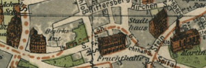
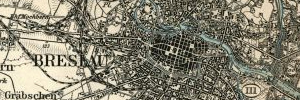
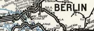
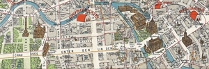
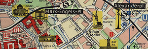
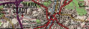
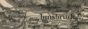
Stadtpläne - Die große Sammlung von historischen Stadtpläne (241 Stadtpläne, 1903-1945), SHELL-Stadtkarten (125 Stadtpläne, 1934-1939), Grieben-Stadtpläne (22 Stadtpläne, 1927-1933), Die große Sammlung von FALK-PL NEN (107 Stadtpläne, 1946-1990), Shell-Lotse (13 Stadtpläne, seit 1954) sowie die große Sammlung kleinerer Verlage ( (279 Stadtpläne, 1900-1945), 1945-1990) (13 Stadtpläne)

Deutschland

Karten aus Reiseführern - Baedecker Stadtpläne und Straßenkarten (161 Karten, 1888-1892)
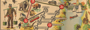
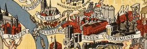
Panoramakarten - Esso Luftbildkarte (22 Karten, -1939), SHELL-Panoramakarten (22 Karten, 1935-1938), GASOLIN-Panoramakarten (10 Karten, ~1954). Diverse Panoramakarten von Deutschland (12 Karten, 1935-1960).

Wundersch ne Panoramakarten von Deutschland

Flusslaufkarten - (Rhein, Mosel, Ahr, Elbe, Weser, Neckar und Tauber, 1905-1990)

Tourenkarten - 89 SHELL-Tourenkarten von 1934/45

Sonderkarten - BZ am Mittag - Berliner Sportplätze (1920), Ein Spaziergang durch Berlin 1:100.000 (1957) IRO-Sonderkarte Berlin (1963) SHELL Olympiakarte München (1972)

Flugpläne (Liniennetzpläne) - Deutsche Luft Hansa (1931)

Motorsportkarten - Nürburgring (1999)

DDR
Stadtpläne

Stadtplan von Berlin - Hauptstadt der DDR

Autoatlanten - Auto-Atlas Neues Deutschland (1958), - Atlas f r Motortouristik (1974), - RV Euro-Reiseatlas Sonderausgabe (1990)

Landkarten - Reisekarte DDR (1986), Autokarte DDR (1986), Reise- und Verkehrskarte der DDR (1959), Verkehrskarte der DDR (1957) - Die Gro e Shell Autokarte 1:750.000 (1990)

Straßenkarten - Bezirkskarte der DDR, Verkehrskarte der DDR

Verkehrskarte der DDR

Landkarten, Stadtpl ne von  sterreich
Topographische Landkarten - Generalkarte von Mitteleuropa (GvM, 622 Karten, 1887-1960), Generalkarte von Central-Europa (63 Karten, 1871-1877), General-Karte des öserreichischen Kaiserstaats (20 Karten, 1856)

 sterreich

Strassenkarten - Esso Österreich (1:930.000, 1954), Esso Österreich (1:930.000, 1959)

Landkarten, Stadtpl ne der Schweiz
Topographische Landkarten - Atlas Suisse (Meyer-Weiss-Atlas, 17 Karten, 1802), Karte der Schweiz (Woerl, 19 Karten, 1831-1835)

Schweiz

Länderkarten - Esso Schweiz (1:500.000, 1952, 1955) und 1959)

Straßenkarten - Pneu Michelin Karte (1:200.000, 1938-1949

Das Universum (Mondlandung, Raumfahrtgeschichte)
Universum

Die Falk Mondkarte (1969),
Hallwag - Die Eroberung des Weltraums (1969)

Universum

Interessante und ungew hnliche Landkarten

Neue Rubrik Kuriose und ungewöhnliche Landkarten und Atlanten sowie interessante und einzigartige Durchfahrtspläne und Dokumente.

Blog

Aktuelles vom Landkartenarchiv

Neue Rubrik Neuigkeiten, neue alte Landkarten, neuste Scans, Themen und Hintergründe. Die interessante Welt des Landkartenarchiv.

News

Das Landkartenkuriosum

Neue Rubrik Entdecken Sie die verrückte, ungewöhnliche, böse und lustige Welt der Landkarten.

Blog


HAUPTSEITE - ÖSTERREICH

GvM - Generalkarte von Mitteleuropa 1:200.000, 1887 - 1960

Die Generalkarte von Mitteleuropa wurde auf Erlass des Wiener Militärgeografischen Institus am 1.7.1879 ins Leben gerufen. Es enstanden 265 Einzelblätter. Eine Karte war eine Zusammenfassung von acht Einzelblättern der Spezialkarte 1:75.000. Das Kartenwerk ist in der Polyeder-Projektion ersellt.


BLATTSCHNITT

ÜBERSICHT

GvM - Generalkarte von Mitteleuropa 25-44 Nizza (Nice) - 1914

GvM - Generalkarte von Mitteleuropa 25-44 Nizza (Nice) - 1940

GvM - Generalkarte von Mitteleuropa 25-45 Turin (Torino) - 1914

GvM - Generalkarte von Mitteleuropa 25-45 Turin (Torino) - 1940

GvM - Generalkarte von Mitteleuropa 26-44 Savona (Savone) - 1906

GvM - Generalkarte von Mitteleuropa 26-44 Savona (Savone) - 1940

GvM - Generalkarte von Mitteleuropa 26-45 Alessandria (Alexandrie) - 1915

GvM - Generalkarte von Mitteleuropa 26-45 Alessandria (Alexandrie) - 1940

GvM - Generalkarte von Mitteleuropa 26-46 Varese (Varèse) - 1915

GvM - Generalkarte von Mitteleuropa 26-46 Varese (Varèse) - 1940

GvM - Generalkarte von Mitteleuropa 26-47 Zürich - 1910

GvM - Generalkarte von Mitteleuropa 26-47 Zürich - 1943

GvM - Generalkarte von Mitteleuropa 26-48 Schaffhausen - 1913

GvM - Generalkarte von Mitteleuropa 26-48 Schaffhausen - 1930

GvM - Generalkarte von Mitteleuropa 26-49 Karlsruhe - 1913

GvM - Generalkarte von Mitteleuropa 26-49 Karlsruhe - 1943

GvM - Generalkarte von Mitteleuropa 26-50 Mainz - 1914

GvM - Generalkarte von Mitteleuropa 26-50 Mainz - 1924

GvM - Generalkarte von Mitteleuropa 27-44 Genua (Genova) - 1903

GvM - Generalkarte von Mitteleuropa 27-44 Genua (Genova) - 1940

GvM - Generalkarte von Mitteleuropa 27-45 Mailand (Milano) - 1940

GvM - Generalkarte von Mitteleuropa 27-45 Mailand (Milano)

GvM - Generalkarte von Mitteleuropa 27-46 Como (Côme) - 1902

GvM - Generalkarte von Mitteleuropa 27-46 Como (Côme) - 1943

GvM - Generalkarte von Mitteleuropa 27-47 Chur (Chur) - 1898

GvM - Generalkarte von Mitteleuropa 27-47 Chur (Chur)

GvM - Generalkarte von Mitteleuropa 27-48 Konstanz - 1904

GvM - Generalkarte von Mitteleuropa 27-48 Konstanz - 1925

GvM - Generalkarte von Mitteleuropa 27-49 Stuttgart - 1905

GvM - Generalkarte von Mitteleuropa 27-49 Stuttgart - 1926

GvM - Generalkarte von Mitteleuropa 27-50 Aschaffenburg - 1924

GvM - Generalkarte von Mitteleuropa 27-50 Aschaffenburg - ~1914

GvM - Generalkarte von Mitteleuropa 27-51 Cassel (Kassel) - 1924

GvM - Generalkarte von Mitteleuropa 27-51 Cassel (Kassel) - ~1906

GvM - Generalkarte von Mitteleuropa 28-43 Insel Elba (Elba) - 1904

GvM - Generalkarte von Mitteleuropa 28-43 Insel Elba (Elba) - 1923

GvM - Generalkarte von Mitteleuropa 28-44 Livorno - 1904

GvM - Generalkarte von Mitteleuropa 28-44 Livorno - 1915

GvM - Generalkarte von Mitteleuropa 28-45 Mantua (Mantova) - 1900

GvM - Generalkarte von Mitteleuropa 28-45 Mantua (Mantova) - 1940

GvM - Generalkarte von Mitteleuropa 28-46 Sondrio - 1899

GvM - Generalkarte von Mitteleuropa 28-46 Sondrio - 1944

GvM - Generalkarte von Mitteleuropa 28-47 Glurns (Glorenza) - 1898

GvM - Generalkarte von Mitteleuropa 28-47 Glurns (Glorenza) - 1946

GvM - Generalkarte von Mitteleuropa 28-48 Ulm - 1907

GvM - Generalkarte von Mitteleuropa 28-48 Ulm - 1935

GvM - Generalkarte von Mitteleuropa 28-49 Ansbach - 1903

GvM - Generalkarte von Mitteleuropa 28-49 Ansbach - 1943

GvM - Generalkarte von Mitteleuropa 28-50 Würzburg - 1912

GvM - Generalkarte von Mitteleuropa 28-50 Würzburg - 1930

GvM - Generalkarte von Mitteleuropa 28-51 Meiningen - 1910

GvM - Generalkarte von Mitteleuropa 28-51 Meiningen - 1939

GvM - Generalkarte von Mitteleuropa 29-42 Civitavecchia - 1903

GvM - Generalkarte von Mitteleuropa 29-42 Civitavecchia - 1943

GvM - Generalkarte von Mitteleuropa 29-43 Siena - 1907

GvM - Generalkarte von Mitteleuropa 29-43 Siena - 1907

GvM - Generalkarte von Mitteleuropa 29-44 Florenz (Firenze) - 1909

GvM - Generalkarte von Mitteleuropa 29-44 Florenz (Firenze) - 1943

GvM - Generalkarte von Mitteleuropa 29-45 Verona - 1909

GvM - Generalkarte von Mitteleuropa 29-45 Verona - 1940

GvM - Generalkarte von Mitteleuropa 29-46 Trient (Trento) - 1898

GvM - Generalkarte von Mitteleuropa 29-46 Trient (Trento) - 1943

GvM - Generalkarte von Mitteleuropa 29-47 Innsbruck - 1905

GvM - Generalkarte von Mitteleuropa 29-47 Innsbruck - 1938

GvM - Generalkarte von Mitteleuropa 29-48 München - 1904

GvM - Generalkarte von Mitteleuropa 29-48 München - 1936

GvM - Generalkarte von Mitteleuropa 29-49 Ingolstadt - 1913

GvM - Generalkarte von Mitteleuropa 29-49 Ingolstadt - 1943

GvM - Generalkarte von Mitteleuropa 29-50 Bamberg - 1897

GvM - Generalkarte von Mitteleuropa 29-50 Bamberg - 1930

GvM - Generalkarte von Mitteleuropa 30-42 Rom (Roma) - 1912

GvM - Generalkarte von Mitteleuropa 30-42 Rom (Roma) - 1943

GvM - Generalkarte von Mitteleuropa 30-43 Perugia - 1912

GvM - Generalkarte von Mitteleuropa 30-43 Perugia - 1943

GvM - Generalkarte von Mitteleuropa 30-44 Ravenna - 1904

GvM - Generalkarte von Mitteleuropa 30-44 Ravenna - 1939

GvM - Generalkarte von Mitteleuropa 30-45 Venedig - 1899

GvM - Generalkarte von Mitteleuropa 30-45 Venedig - 1940

GvM - Generalkarte von Mitteleuropa 30-46 Belluno - 1899

GvM - Generalkarte von Mitteleuropa 30-46 Belluno - 1940

GvM - Generalkarte von Mitteleuropa 30-47 Bruneck (Brunico) - 1898

GvM - Generalkarte von Mitteleuropa 30-47 Bruneck (Brunico) - 1946

GvM - Generalkarte von Mitteleuropa 30-48 Kufstein - 1904

GvM - Generalkarte von Mitteleuropa 30-48 Kufstein - 1937

GvM - Generalkarte von Mitteleuropa 30-49 Regensburg - 1902

GvM - Generalkarte von Mitteleuropa 30-49 Regensburg - 1930

GvM - Generalkarte von Mitteleuropa 30-50 Eger (Cheb) - 1900

GvM - Generalkarte von Mitteleuropa 30-50 Eger (Cheb) - 1939

GvM - Generalkarte von Mitteleuropa 30-51 Leipzig - 1898

GvM - Generalkarte von Mitteleuropa 30-51 Leipzig - 1924

GvM - Generalkarte von Mitteleuropa 31-43 Ascoli (Ascoli Piceno) - 1943

GvM - Generalkarte von Mitteleuropa 31-43 Ascoli (Ascoli Piceno)

GvM - Generalkarte von Mitteleuropa 31-44 Ancona - 1900

GvM - Generalkarte von Mitteleuropa 31-44 Ancona - 1939

GvM - Generalkarte von Mitteleuropa 31-45 Rovigno (Rovinj) - 1940

GvM - Generalkarte von Mitteleuropa 31-45 Rovigno (Rovinj)

GvM - Generalkarte von Mitteleuropa 31-46 Triest (Trieste) - 1909

GvM - Generalkarte von Mitteleuropa 31-46 Triest (Trieste) - 1947

GvM - Generalkarte von Mitteleuropa 31-46 Triest (Trieste) - 1905

GvM - Generalkarte von Mitteleuropa 31-47 Hofgastein (Bad Hofgastein) - 1895

GvM - Generalkarte von Mitteleuropa 31-47 Hofgastein (Bad Hofgastein) - 1940

GvM - Generalkarte von Mitteleuropa 31-48 Salzburg - 1900

GvM - Generalkarte von Mitteleuropa 31-48 Salzburg - 1947

GvM - Generalkarte von Mitteleuropa 31-49 Passau - 1900

GvM - Generalkarte von Mitteleuropa 31-49 Passau - 1939

GvM - Generalkarte von Mitteleuropa 31-50 Pilsen (Plzen) - 1894

GvM - Generalkarte von Mitteleuropa 31-50 Pilsen (Plzen) - 1939

GvM - Generalkarte von Mitteleuropa 31-51 Dresden - 1898

GvM - Generalkarte von Mitteleuropa 31-51 Dresden - 1930

GvM - Generalkarte von Mitteleuropa 31-51 Dresden - 1915

GvM - Generalkarte von Mitteleuropa 31-53 Berlin - 1898

GvM - Generalkarte von Mitteleuropa 31-53 Berlin - 1939

GvM - Generalkarte von Mitteleuropa 32-44 Insel Selve (Silba) - 1893

GvM - Generalkarte von Mitteleuropa 32-44 Insel Selve (Silba) - 1940

GvM - Generalkarte von Mitteleuropa 32-45 Pola (Pula) - 1938

GvM - Generalkarte von Mitteleuropa 32-45 Pola (Pula)

GvM - Generalkarte von Mitteleuropa 32-46 Laibach (Ljubljana) - 1893

GvM - Generalkarte von Mitteleuropa 32-46 Laibach (Ljubljana) - 1940

GvM - Generalkarte von Mitteleuropa 32-46 Laibach (Ljubljana) - 1914

GvM - Generalkarte von Mitteleuropa 32-47 Klagenfurt - 1894

GvM - Generalkarte von Mitteleuropa 32-47 Klagenfurt

GvM - Generalkarte von Mitteleuropa 32-48 Linz - 1893

GvM - Generalkarte von Mitteleuropa 32-49 Budweis (Ceske Budéjovice) - 1893

GvM - Generalkarte von Mitteleuropa 32-49 Budweis (Ceske Budéjovice) - 1915

GvM - Generalkarte von Mitteleuropa 32-50 Prag (Praha, Prague) - 1893

GvM - Generalkarte von Mitteleuropa 32-50 Prag (Praha, Prague) - 1931

GvM - Generalkarte von Mitteleuropa 32-51 Bautzen - 1896

GvM - Generalkarte von Mitteleuropa 32-51 Bautzen - 1939

GvM - Generalkarte von Mitteleuropa 32-53 Stettin (Szczecin) - 1904

GvM - Generalkarte von Mitteleuropa 32-53 Stettin (Szczecin) - 1939

GvM - Generalkarte von Mitteleuropa 33-44 Zara (Zadar) - 1940

GvM - Generalkarte von Mitteleuropa 33-44 Zara (Zadar)

GvM - Generalkarte von Mitteleuropa 33-45 Senj - 1939

GvM - Generalkarte von Mitteleuropa 33-45 Senj

GvM - Generalkarte von Mitteleuropa 33-46 Cilli (Celje) (Zadar) - 1948

GvM - Generalkarte von Mitteleuropa 33-46 Cilli (Celje) (Zadar)

GvM - Generalkarte von Mitteleuropa 33-47 Graz - 1893

GvM - Generalkarte von Mitteleuropa 33-47 Graz - 1947

GvM - Generalkarte von Mitteleuropa 33-48 St. Pölten - 1946

GvM - Generalkarte von Mitteleuropa 33-48 St. Pölten

GvM - Generalkarte von Mitteleuropa 33-49 Iglau (Jihlava) - 1909

GvM - Generalkarte von Mitteleuropa 33-49 Iglau (Jihlava)

GvM - Generalkarte von Mitteleuropa 33-50 Kolin - 1893

GvM - Generalkarte von Mitteleuropa 33-50 Kolin - 1909

GvM - Generalkarte von Mitteleuropa 33-51 Reichenberg (Liberec) - 1896

GvM - Generalkarte von Mitteleuropa 33-51 Reichenberg (Liberec) - 1930

GvM - Generalkarte von Mitteleuropa 33-53 Landenberg (Gorzów Wielkopolski) - 1909

GvM - Generalkarte von Mitteleuropa 33-53 Landenberg (Gorzów Wielkopolski) - 1939

GvM - Generalkarte von Mitteleuropa 34-43 I. Lissa (Vis) - 1894

GvM - Generalkarte von Mitteleuropa 34-43 I. Lissa (Vis) - 1939

GvM - Generalkarte von Mitteleuropa 34-44 Spalato (Split) - 1939

GvM - Generalkarte von Mitteleuropa 34-44 Spalato (Split)

GvM - Generalkarte von Mitteleuropa 34-45 Kostajnica (Hrvatska Kostajnica) - 1940

GvM - Generalkarte von Mitteleuropa 34-45 Kostajnica (Hrvatska Kostajnica)

GvM - Generalkarte von Mitteleuropa 34-46 Zagreb (Agram) - 1947

GvM - Generalkarte von Mitteleuropa 34-46 Zagreb (Agram)

GvM - Generalkarte von Mitteleuropa 34-47 Steinamanger (Szombathely) - 1940

GvM - Generalkarte von Mitteleuropa 34-47 Steinamanger (Szombathely)

GvM - Generalkarte von Mitteleuropa 34-48 Wien (Vienna) / Sorpon (Ödenburg) - 1946

GvM - Generalkarte von Mitteleuropa 34-48 Wien (Vienna) / Sorpon (Ödenburg)

GvM - Generalkarte von Mitteleuropa 34-49 Brünn (Brno) - 1939

GvM - Generalkarte von Mitteleuropa 34-49 Brünn (Brno)

GvM - Generalkarte von Mitteleuropa 34-50 Josefstadt (Klodzko) - 1893

GvM - Generalkarte von Mitteleuropa 34-50 Josefstadt (Klodzko) - 1939

GvM - Generalkarte von Mitteleuropa 34-51 Schweidnitz (Swiknica) - 1896

GvM - Generalkarte von Mitteleuropa 34-52 Glogau (Glogów) - 1906

GvM - Generalkarte von Mitteleuropa 34-52 Glogau (Glogów) - 1939

GvM - Generalkarte von Mitteleuropa 34-53 Schneidemühl (Pila) - 1906

GvM - Generalkarte von Mitteleuropa 34-53 Schneidemühl (Pila) - 1932

GvM - Generalkarte von Mitteleuropa 35-43 Mostar (Moster) - 1895

GvM - Generalkarte von Mitteleuropa 35-43 Mostar (Moster) - 1940

GvM - Generalkarte von Mitteleuropa 35-44 Travnik - 1896

GvM - Generalkarte von Mitteleuropa 35-44 Travnik - 1939

GvM - Generalkarte von Mitteleuropa 35-45 Banja Luka - 1939

GvM - Generalkarte von Mitteleuropa 35-45 Banja Luka

GvM - Generalkarte von Mitteleuropa 35-46 Nagykanizsa és Bjelovar (Nagykanizsa) - 1940

GvM - Generalkarte von Mitteleuropa 35-46 Nagykanizsa és Bjelovar (Nagykanizsa)

GvM - Generalkarte von Mitteleuropa 35-47 Pápa - 1939

GvM - Generalkarte von Mitteleuropa 35-47 Pápa

GvM - Generalkarte von Mitteleuropa 35-48 Pressburg (Bratislava)

GvM - Generalkarte von Mitteleuropa 35-49 Breclava (Lundenburg) - 1912

GvM - Generalkarte von Mitteleuropa 35-49 Breclava (Lundenburg) - 1914

GvM - Generalkarte von Mitteleuropa 35-49 Breclava (Lundenburg) - 1918

GvM - Generalkarte von Mitteleuropa 35-49 Breclava (Lundenburg) - 1913

GvM - Generalkarte von Mitteleuropa 35-50 Olmütz (Olomouc) - 1914

GvM - Generalkarte von Mitteleuropa 35-50 Olmütz (Olomouc) - 1932

GvM - Generalkarte von Mitteleuropa 35-50 Olmütz (Olomouc) - 1914

GvM - Generalkarte von Mitteleuropa 35-51 Breslau (Wroclaw) - 1894

GvM - Generalkarte von Mitteleuropa 35-51 Breslau (Wroclaw) - 1908

GvM - Generalkarte von Mitteleuropa 35-52 Posen (Poznán) - 1896

GvM - Generalkarte von Mitteleuropa 35-52 Posen (Poznán) - 1939

GvM - Generalkarte von Mitteleuropa 35-53 Nakel (Naklo nad Notecia) - 1939

GvM - Generalkarte von Mitteleuropa 35-53 Nakel (Naklo nad Notecia)

GvM - Generalkarte von Mitteleuropa 36-42 Kotor (Cattaro) - 1894

GvM - Generalkarte von Mitteleuropa 36-42 Kotor (Cattaro) - 1940

GvM - Generalkarte von Mitteleuropa 36-43 Ragusa (Dubrovnik) - 1895

GvM - Generalkarte von Mitteleuropa 36-43 Ragusa (Dubrovnik) - 1939

GvM - Generalkarte von Mitteleuropa 36-44 Sarajevo - 1895

GvM - Generalkarte von Mitteleuropa 36-44 Sarajevo - 1939

GvM - Generalkarte von Mitteleuropa 36-45 Brod (Slavonski Brod) - 1939

GvM - Generalkarte von Mitteleuropa 36-45 Brod (Slavonski Brod)

GvM - Generalkarte von Mitteleuropa 36-46 Fünfkirchen (Pécs) - 1939

GvM - Generalkarte von Mitteleuropa 36-46 Fünfkirchen (Pécs)

GvM - Generalkarte von Mitteleuropa 36-47 Székesfehérvár - 1939

GvM - Generalkarte von Mitteleuropa 36-47 Székesfehérvár

GvM - Generalkarte von Mitteleuropa 36-48 Komarno (Komárom) - 1946

GvM - Generalkarte von Mitteleuropa 36-48 Komarno (Komárom)

GvM - Generalkarte von Mitteleuropa 36-49 Trentschin (Trencín) - 1914

GvM - Generalkarte von Mitteleuropa 36-49 Trentschin (Trencín) - 1939

GvM - Generalkarte von Mitteleuropa 36-49 Trentschin (Trencín) - 1913

GvM - Generalkarte von Mitteleuropa 36-49 Trentschin (Trencín) - 1914

GvM - Generalkarte von Mitteleuropa 36-50 Troppau (Opava) - 1914

GvM - Generalkarte von Mitteleuropa 36-50 Troppau (Opava) - 1939

GvM - Generalkarte von Mitteleuropa 36-50 Troppau (Opava) - 1919

GvM - Generalkarte von Mitteleuropa 36-50 Troppau (Opava) - 1914

GvM - Generalkarte von Mitteleuropa 36-51 Oppeln (Opole) - 1890

GvM - Generalkarte von Mitteleuropa 36-51 Oppeln (Opole) - 1939

GvM - Generalkarte von Mitteleuropa 36-51 Oppeln (Opole) - 1914

GvM - Generalkarte von Mitteleuropa 36-52 Kalisz - 1914

GvM - Generalkarte von Mitteleuropa 36-52 Kalisz - 1939

GvM - Generalkarte von Mitteleuropa 36-53 Thorn (Torun) - 1896

GvM - Generalkarte von Mitteleuropa 36-53 Thorn (Torun) - 1939

GvM - Generalkarte von Mitteleuropa 37-40 Valona (Vlore) - 1909

GvM - Generalkarte von Mitteleuropa 37-40 Valona (Vlore) - 1918

GvM - Generalkarte von Mitteleuropa 37-41 Durazzo (Durz, Durres) - 1917

GvM - Generalkarte von Mitteleuropa 37-41 Durazzo (Durz, Durres)

GvM - Generalkarte von Mitteleuropa 37-42 Scutari (Shkoder) - 1903

GvM - Generalkarte von Mitteleuropa 37-42 Scutari (Shkoder) - 1904

GvM - Generalkarte von Mitteleuropa 37-43 Plevlje (Pljevlja) - 1900

GvM - Generalkarte von Mitteleuropa 37-43 Plevlje (Pljevlja) - 1940

GvM - Generalkarte von Mitteleuropa 37-44 Zvornik - 1913

GvM - Generalkarte von Mitteleuropa 37-44 Zvornik - 1940

GvM - Generalkarte von Mitteleuropa 37-45 Mistrowitz (Mitrovitz, Mitrovica) / Sremska (Szabadka) - 1939

GvM - Generalkarte von Mitteleuropa 37-45 Mistrowitz (Mitrovitz, Mitrovica) / Sremska (Szabadka)

GvM - Generalkarte von Mitteleuropa 37-46 Maria Thérésiopel / Baja Subotica - 1940

GvM - Generalkarte von Mitteleuropa 37-46 Maria Thérésiopel / Baja Subotica

GvM - Generalkarte von Mitteleuropa 37-47 Budapest / Kecskemét - 1939

GvM - Generalkarte von Mitteleuropa 37-47 Budapest / Kecskemét

GvM - Generalkarte von Mitteleuropa 37-48 Budapest / Losoncz (Lucenec) - 1940

GvM - Generalkarte von Mitteleuropa 37-48 Budapest / Losoncz (Lucenec)

GvM - Generalkarte von Mitteleuropa 37-48 Budapest / Losoncz (Lucenec) - 1912

GvM - Generalkarte von Mitteleuropa 37-49 Neusohl (Ziar nad) - 1943

GvM - Generalkarte von Mitteleuropa 37-49 Neusohl (Ziar nad)

GvM - Generalkarte von Mitteleuropa 37-49 Neusohl (Ziar nad) - 1914

GvM - Generalkarte von Mitteleuropa 37-50 Oswiecim (Auschwitz) / Kattovice (Katowice) - 1914

GvM - Generalkarte von Mitteleuropa 37-50 Oswiecim (Auschwitz) / Kattovice (Katowice) - 1939

GvM - Generalkarte von Mitteleuropa 37-50 Oswiecim (Auschwitz) / Kattovice (Katowice) - 1939

GvM - Generalkarte von Mitteleuropa 37-50 Oswiecim (Auschwitz) / Kattovice (Katowice) - 1914

GvM - Generalkarte von Mitteleuropa 37-51 Czestochowa - 1890

GvM - Generalkarte von Mitteleuropa 37-51 Czestochowa - 1914

GvM - Generalkarte von Mitteleuropa 37-52 Lódz - 1915

GvM - Generalkarte von Mitteleuropa 37-52 Lódz - 1939

GvM - Generalkarte von Mitteleuropa 37-53 Plock - 1914

GvM - Generalkarte von Mitteleuropa 37-53 Plock - 1939

GvM - Generalkarte von Mitteleuropa 38-39 Prevenza (Préveza) - 1912

GvM - Generalkarte von Mitteleuropa 38-39 Prevenza (Préveza) - 1940

GvM - Generalkarte von Mitteleuropa 38-40 Korfu (Kerkira, Kerkyra) - 1914

GvM - Generalkarte von Mitteleuropa 38-40 Korfu (Kerkira, Kerkyra)

GvM - Generalkarte von Mitteleuropa 38-41 Elbasan - 1898

GvM - Generalkarte von Mitteleuropa 38-41 Elbasan - 1914

GvM - Generalkarte von Mitteleuropa 38-42 Prizren - 1902

GvM - Generalkarte von Mitteleuropa 38-42 Prizren - 1902

GvM - Generalkarte von Mitteleuropa 38-43 Novipazar - 1898

GvM - Generalkarte von Mitteleuropa 38-43 Novipazar - 1940

GvM - Generalkarte von Mitteleuropa 38-44 Uzice - 1940

GvM - Generalkarte von Mitteleuropa 38-44 Uzice

GvM - Generalkarte von Mitteleuropa 38-45 Belgrád (Beograd, Belgrade) - 1940

GvM - Generalkarte von Mitteleuropa 38-45 Belgrád (Beograd, Belgrade)

GvM - Generalkarte von Mitteleuropa 38-46 Szeged - 1939

GvM - Generalkarte von Mitteleuropa 38-46 Szeged

GvM - Generalkarte von Mitteleuropa 38-47 Szolnok - 1939

GvM - Generalkarte von Mitteleuropa 38-47 Szolnok

GvM - Generalkarte von Mitteleuropa 38-48 Miskolcz (Miskolc) - 1940

GvM - Generalkarte von Mitteleuropa 38-48 Miskolcz (Miskolc)

GvM - Generalkarte von Mitteleuropa 38-49 Leutschau (Loecse, Levoca) - 1914

GvM - Generalkarte von Mitteleuropa 38-49 Leutschau (Loecse, Levoca) - 1932

GvM - Generalkarte von Mitteleuropa 38-49 Leutschau (Loecse, Levoca) - 1914

GvM - Generalkarte von Mitteleuropa 38-50 Krakau (Kraków) - 1914

GvM - Generalkarte von Mitteleuropa 38-50 Krakau (Kraków) - 1944

GvM - Generalkarte von Mitteleuropa 38-50 Krakau (Kraków) - 1930

GvM - Generalkarte von Mitteleuropa 38-50 Krakau (Kraków) - 1914

GvM - Generalkarte von Mitteleuropa 38-51 Kielce - 1890

GvM - Generalkarte von Mitteleuropa 38-51 Kielce - 1939

GvM - Generalkarte von Mitteleuropa 38-51 Kielce - 1913

GvM - Generalkarte von Mitteleuropa 38-52 Modlin (Nowogeorgiewsk (Nowy Dwór Mazowiecki)) - 1939

GvM - Generalkarte von Mitteleuropa 38-52 Modlin (Nowogeorgiewsk (Nowy Dwór Mazowiecki))

GvM - Generalkarte von Mitteleuropa 38-53 Mlawa (Mlava) - 1914

GvM - Generalkarte von Mitteleuropa 38-53 Mlawa (Mlava) - 1939

GvM - Generalkarte von Mitteleuropa 39-39 Arta - 1940

GvM - Generalkarte von Mitteleuropa 39-39 Arta

GvM - Generalkarte von Mitteleuropa 39-40 Janina (Joanina) (Ioannina) - 1940

GvM - Generalkarte von Mitteleuropa 39-40 Janina (Joanina) (Ioannina)

GvM - Generalkarte von Mitteleuropa 39-41 Monastir (Bitola (Bitolj)) - 1900

GvM - Generalkarte von Mitteleuropa 39-41 Monastir (Bitola (Bitolj)) - 1940

GvM - Generalkarte von Mitteleuropa 39-42 Skoplje (Skopje) - 1900

GvM - Generalkarte von Mitteleuropa 39-42 Skoplje (Skopje) - 1940

GvM - Generalkarte von Mitteleuropa 39-43 Pristina - 1900

GvM - Generalkarte von Mitteleuropa 39-43 Pristina - 1940

GvM - Generalkarte von Mitteleuropa 39-44 Kragujevac (Kragujevac) - 1914

GvM - Generalkarte von Mitteleuropa 39-44 Kragujevac (Kragujevac) - 1940

GvM - Generalkarte von Mitteleuropa 39-45 Werschetz (Vrsac, Versecz) - 1940

GvM - Generalkarte von Mitteleuropa 39-45 Werschetz (Vrsac, Versecz)

GvM - Generalkarte von Mitteleuropa 39-45 Werschetz (Vrsac, Versecz) - 1943

GvM - Generalkarte von Mitteleuropa 39-46 Temeschburg (Temesvár, Timisoara) - 1939

GvM - Generalkarte von Mitteleuropa 39-46 Temeschburg (Temesvár, Timisoara)

GvM - Generalkarte von Mitteleuropa 39-46 Temeschburg (Temesvár, Timisoara) - 1944

GvM - Generalkarte von Mitteleuropa 39-47 Békéscaba - 1892

GvM - Generalkarte von Mitteleuropa 39-47 Békéscaba - 1939

GvM - Generalkarte von Mitteleuropa 39-48 Debreczen - 1940

GvM - Generalkarte von Mitteleuropa 39-48 Debreczen - 1948

GvM - Generalkarte von Mitteleuropa 39-48 Debreczen - 1914

GvM - Generalkarte von Mitteleuropa 39-49 Kaschau (Kosice, Kassa) - 1914

GvM - Generalkarte von Mitteleuropa 39-49 Kaschau (Kosice, Kassa) - 1940

GvM - Generalkarte von Mitteleuropa 39-49 Kaschau (Kosice, Kassa) - 1914

GvM - Generalkarte von Mitteleuropa 39-50 Tarnów - 1900

GvM - Generalkarte von Mitteleuropa 39-50 Tarnów - 1939

GvM - Generalkarte von Mitteleuropa 39-50 Tarnów - 1914

GvM - Generalkarte von Mitteleuropa 39-51 Radom - 1889

GvM - Generalkarte von Mitteleuropa 39-51 Radom - 1939

GvM - Generalkarte von Mitteleuropa 39-52 Warschau (Warszawa, Warsaw) - 1939

GvM - Generalkarte von Mitteleuropa 39-52 Warschau (Warszawa, Warsaw) - 1939

GvM - Generalkarte von Mitteleuropa 39-53 Ostroleka (Ostroleca) - 1901

GvM - Generalkarte von Mitteleuropa 39-53 Ostroleka (Ostroleca) - 1939

GvM - Generalkarte von Mitteleuropa 40-39 Lamia

GvM - Generalkarte von Mitteleuropa 40-40 Larisa - 1940

GvM - Generalkarte von Mitteleuropa 40-40 Larisa

GvM - Generalkarte von Mitteleuropa 40-41 Vodena (Edessa) - 1904

GvM - Generalkarte von Mitteleuropa 40-41 Vodena (Edessa) - 1939

GvM - Generalkarte von Mitteleuropa 40-42 Egri Palanka (Kriva Palanka) - 1900

GvM - Generalkarte von Mitteleuropa 40-42 Egri Palanka (Kriva Palanka) - 1940

GvM - Generalkarte von Mitteleuropa 40-43 Nis - 1898

GvM - Generalkarte von Mitteleuropa 40-43 Nis - 1939

GvM - Generalkarte von Mitteleuropa 40-44 Zajecar - 1940

GvM - Generalkarte von Mitteleuropa 40-44 Zajecar

GvM - Generalkarte von Mitteleuropa 40-45 Orsova - 1939

GvM - Generalkarte von Mitteleuropa 40-45 Orsova

GvM - Generalkarte von Mitteleuropa 40-46 Lugos (Lugoj) - 1939

GvM - Generalkarte von Mitteleuropa 40-46 Lugos (Lugoj)

GvM - Generalkarte von Mitteleuropa 40-47 Großwardein (Oradea) - 1939

GvM - Generalkarte von Mitteleuropa 40-47 Großwardein (Oradea)

GvM - Generalkarte von Mitteleuropa 40-47 Großwardein (Oradea) - 1943

GvM - Generalkarte von Mitteleuropa 40-48 Munkács (Mukacheve) - 1940

GvM - Generalkarte von Mitteleuropa 40-48 Munkács (Mukacheve) - 1941

GvM - Generalkarte von Mitteleuropa 40-48 Munkács (Mukacheve)

GvM - Generalkarte von Mitteleuropa 40-48 Munkács (Mukacheve) - 1913

GvM - Generalkarte von Mitteleuropa 40-49 Ungvar (Uzhorod) - 1914

GvM - Generalkarte von Mitteleuropa 40-49 Ungvar (Uzhorod) - 1939

GvM - Generalkarte von Mitteleuropa 40-49 Ungvar (Uzhorod) - 1914

GvM - Generalkarte von Mitteleuropa 40-50 Przemysel (Przemysl) - 1914

GvM - Generalkarte von Mitteleuropa 40-50 Przemysel (Przemysl) - 1939

GvM - Generalkarte von Mitteleuropa 40-50 Przemysel (Przemysl) - 1914

GvM - Generalkarte von Mitteleuropa 40-51 Lublin - 1889

GvM - Generalkarte von Mitteleuropa 40-51 Lublin - 1939

GvM - Generalkarte von Mitteleuropa 40-51 Lublin - 1917

GvM - Generalkarte von Mitteleuropa 40-51 Lublin - 1914

GvM - Generalkarte von Mitteleuropa 40-52 Siedlec - 1914

GvM - Generalkarte von Mitteleuropa 40-52 Siedlec - 1939

GvM - Generalkarte von Mitteleuropa 40-52 Siedlec - 1913

GvM - Generalkarte von Mitteleuropa 40-53 Lomza - 1900

GvM - Generalkarte von Mitteleuropa 40-53 Lomza - 1939

GvM - Generalkarte von Mitteleuropa 41-39 Volos

GvM - Generalkarte von Mitteleuropa 41-40 Chalkidiki (Halkiziki) - 1899

GvM - Generalkarte von Mitteleuropa 41-40 Chalkidiki (Halkiziki) - 1940

GvM - Generalkarte von Mitteleuropa 41-41 Saloniki (Thessaloniki) - 1940

GvM - Generalkarte von Mitteleuropa 41-41 Saloniki (Thessaloniki)

GvM - Generalkarte von Mitteleuropa 41-42 Gorna (Dzumaja) (Blagoevgrad) - 1940

GvM - Generalkarte von Mitteleuropa 41-42 Gorna (Dzumaja) (Blagoevgrad)

GvM - Generalkarte von Mitteleuropa 41-43 Sofia (Sofiya) - 1898

GvM - Generalkarte von Mitteleuropa 41-43 Sofia (Sofiya) - 1940

GvM - Generalkarte von Mitteleuropa 41-44 Vidin - 1940

GvM - Generalkarte von Mitteleuropa 41-44 Vidin

GvM - Generalkarte von Mitteleuropa 41-45 Targu-Jiu - 1940

GvM - Generalkarte von Mitteleuropa 41-45 Targu-Jiu

GvM - Generalkarte von Mitteleuropa 41-46 Karlsburg (Alba Iulia, Gyala-Fehérvár) - 1939

GvM - Generalkarte von Mitteleuropa 41-46 Karlsburg (Alba Iulia, Gyala-Fehérvár)

GvM - Generalkarte von Mitteleuropa 41-47 Klausenburg (Kolozsvár, Cluj-Napoca) - 1939

GvM - Generalkarte von Mitteleuropa 41-47 Klausenburg (Kolozsvár, Cluj-Napoca)

GvM - Generalkarte von Mitteleuropa 41-47 Klausenburg (Kolozsvár, Cluj-Napoca) - 1913

GvM - Generalkarte von Mitteleuropa 41-48 Szatmár (Satu Mare) (Nemeti) - 1915

GvM - Generalkarte von Mitteleuropa 41-48 Szatmár (Satu Mare) (Nemeti) - 1939

GvM - Generalkarte von Mitteleuropa 41-48 Szatmár (Satu Mare) (Nemeti)

GvM - Generalkarte von Mitteleuropa 41-48 Szatmár (Satu Mare) (Nemeti) - 1914

GvM - Generalkarte von Mitteleuropa 41-49 Turka - 1940

GvM - Generalkarte von Mitteleuropa 41-49 Turka

GvM - Generalkarte von Mitteleuropa 41-49 Turka - 1914

GvM - Generalkarte von Mitteleuropa 41-50 Samor (Sambir) - 1889

GvM - Generalkarte von Mitteleuropa 41-50 Samor (Sambir) - 1939

GvM - Generalkarte von Mitteleuropa 41-50 Samor (Sambir) - 1918

GvM - Generalkarte von Mitteleuropa 41-51 Zamosc - 1889

GvM - Generalkarte von Mitteleuropa 41-51 Zamosc - 1939

GvM - Generalkarte von Mitteleuropa 41-51 Zamosc - 1918

GvM - Generalkarte von Mitteleuropa 41-52 Brest (Brest Litowsk) - 1939

GvM - Generalkarte von Mitteleuropa 41-52 Brest (Brest Litowsk)

GvM - Generalkarte von Mitteleuropa 41-52 Brest (Brest Litowsk) - 1913

GvM - Generalkarte von Mitteleuropa 41-53 Biatystok (Bielostok) - 1914

GvM - Generalkarte von Mitteleuropa 41-53 Biatystok (Bielostok) - 1939

GvM - Generalkarte von Mitteleuropa 42-38 Lawrion - 1944

GvM - Generalkarte von Mitteleuropa 42-39 Skyros

GvM - Generalkarte von Mitteleuropa 42-40 Asos (Athos) - 1899

GvM - Generalkarte von Mitteleuropa 42-40 Asos (Athos) - 1940

GvM - Generalkarte von Mitteleuropa 42-41 Kawalla (Kavala) - 1901

GvM - Generalkarte von Mitteleuropa 42-41 Kawalla (Kavala) - 1940

GvM - Generalkarte von Mitteleuropa 42-42 Plovdir (Philippopel) - 1903

GvM - Generalkarte von Mitteleuropa 42-42 Plovdir (Philippopel) - 1940

GvM - Generalkarte von Mitteleuropa 42-43 Plewen (Plevna) - 1897

GvM - Generalkarte von Mitteleuropa 42-43 Plewen (Plevna) - 1940

GvM - Generalkarte von Mitteleuropa 42-44 Slatina - 1912

GvM - Generalkarte von Mitteleuropa 42-44 Slatina - 1940

GvM - Generalkarte von Mitteleuropa 42-45 Râmnicu-Valcea - 1939

GvM - Generalkarte von Mitteleuropa 42-45 Ramnicu Valcea

GvM - Generalkarte von Mitteleuropa 42-46 Sibiu (Hermannstadt) / Nagy (Szeben) - 1939

GvM - Generalkarte von Mitteleuropa 42-46 Sibiu (Hermannstadt) / Nagy (Szeben)

GvM - Generalkarte von Mitteleuropa 42-47 Besztercze (Bistritz, Bistrita) - 1939

GvM - Generalkarte von Mitteleuropa 42-47 Besztercze (Bistritz, Bistrita)

GvM - Generalkarte von Mitteleuropa 42-48 Maramaros-Sziget (Sihetu) - 1940

GvM - Generalkarte von Mitteleuropa 42-48 Maramaros-Sziget (Sihetu)

GvM - Generalkarte von Mitteleuropa 42-48 Maramaros-Sziget (Sihetu) - 1914

GvM - Generalkarte von Mitteleuropa 42-49 Stanislau (Ivano- Frankivsk) - 1913

GvM - Generalkarte von Mitteleuropa 42-49 Stanislau (Ivano- Frankivsk) - 1940

GvM - Generalkarte von Mitteleuropa 42-49 Stanislau (Ivano- Frankivsk) - 1913

GvM - Generalkarte von Mitteleuropa 42-50 Lemberg (L'viv) - 1889

GvM - Generalkarte von Mitteleuropa 42-50 Lemberg (L'viv) - 1939

GvM - Generalkarte von Mitteleuropa 42-50 Lemberg (L'viv) - 1924

GvM - Generalkarte von Mitteleuropa 42-50 Lemberg (L'viv) - 1915

GvM - Generalkarte von Mitteleuropa 42-51 Kowel (Kovel) - 1889

GvM - Generalkarte von Mitteleuropa 42-51 Kowel (Kovel) - 1913

GvM - Generalkarte von Mitteleuropa 42-51 Kowel (Kovel) - 1914

GvM - Generalkarte von Mitteleuropa 42-52 Kobrin (Kobryn) - 1939

GvM - Generalkarte von Mitteleuropa 42-52 Kobrin (Kobryn)

GvM - Generalkarte von Mitteleuropa 42-52 Kobrin (Kobryn) - 1913

GvM - Generalkarte von Mitteleuropa 42-53 Wolkowisk (Vawkavysk) - 1939

GvM - Generalkarte von Mitteleuropa 42-53 Wolkowisk (Vawkavysk)

GvM - Generalkarte von Mitteleuropa 43-40 I. Lemnos (Lemni) (Limnos) - 1940

GvM - Generalkarte von Mitteleuropa 43-40 I. Lemnos (Lemni) (Limnos)

GvM - Generalkarte von Mitteleuropa 43-41 Xanthi - 1907

GvM - Generalkarte von Mitteleuropa 43-41 Xanthi - 1940

GvM - Generalkarte von Mitteleuropa 43-42 Stara Zagora (Eski Zagra) - 1913

GvM - Generalkarte von Mitteleuropa 43-42 Stara Zagora (Eski Zagra) - 1940

GvM - Generalkarte von Mitteleuropa 43-43 Trnovo (Tarnowo, Turnovo) - 1940

GvM - Generalkarte von Mitteleuropa 43-43 Trnovo (Tarnowo, Turnovo) - 1940

GvM - Generalkarte von Mitteleuropa 43-43 Trnovo (Tarnowo, Turnovo)

GvM - Generalkarte von Mitteleuropa 43-44 Svistov (Svishtov) - 1914

GvM - Generalkarte von Mitteleuropa 43-44 Svistov (Svishtov) - 1939

GvM - Generalkarte von Mitteleuropa 43-45 Târgoviste (Târgoviste) - 1939

GvM - Generalkarte von Mitteleuropa 43-45 Târgoviste (Târgoviste)

GvM - Generalkarte von Mitteleuropa 43-46 Kronstadt (Brasso) (Brasov) - 1939

GvM - Generalkarte von Mitteleuropa 43-46 Kronstadt (Brasso) (Brasov)

GvM - Generalkarte von Mitteleuropa 43-47 Gheorgheni (Gyergyó-SZT-Miklos) - 1940

GvM - Generalkarte von Mitteleuropa 43-47 Gheorgheni (Gyergyó-SZT-Miklos)

GvM - Generalkarte von Mitteleuropa 43-48 Siniatyn (Snyatyn) - 1940

GvM - Generalkarte von Mitteleuropa 43-48 Siniatyn (Snyatyn)

GvM - Generalkarte von Mitteleuropa 43-48 Siniatyn (Snyatyn) - 1913

GvM - Generalkarte von Mitteleuropa 43-48 Siniatyn (Snyatyn) - 1916

GvM - Generalkarte von Mitteleuropa 43-48 Siniatyn (Snyatyn) - 1944

GvM - Generalkarte von Mitteleuropa 43-49 Kolomea (Kolomyia) - 1914

GvM - Generalkarte von Mitteleuropa 43-49 Kolomea (Kolomyia) - 1940

GvM - Generalkarte von Mitteleuropa 43-49 Kolomea (Kolomyia) - 1914

GvM - Generalkarte von Mitteleuropa 43-49 Kolomea (Kolomyia) - 1944

GvM - Generalkarte von Mitteleuropa 43-50 Brody - 1889

GvM - Generalkarte von Mitteleuropa 43-50 Brody - 1939

GvM - Generalkarte von Mitteleuropa 43-50 Brody - 1914

GvM - Generalkarte von Mitteleuropa 43-50 Brody - 1915

GvM - Generalkarte von Mitteleuropa 43-51 Luck (Luts'k) - 1939

GvM - Generalkarte von Mitteleuropa 43-51 Luck (Luts'k)

GvM - Generalkarte von Mitteleuropa 43-51 Luck (Luts'k)

GvM - Generalkarte von Mitteleuropa 43-51 Luck (Luts'k) - 1913

GvM - Generalkarte von Mitteleuropa 43-52 Drogiczyn (Drahichyn) - 1939

GvM - Generalkarte von Mitteleuropa 43-52 Drogiczyn (Drahichyn)

GvM - Generalkarte von Mitteleuropa 43-52 Drogiczyn (Drahichyn) - 1913

GvM - Generalkarte von Mitteleuropa 43-53 Slonim - 1939

GvM - Generalkarte von Mitteleuropa 43-53 Slonim

GvM - Generalkarte von Mitteleuropa 44-40 Gallipoli (Gelibolu) (Çanakkale) - 1940

GvM - Generalkarte von Mitteleuropa 44-40 Gallipoli (Gelibolu) (Çanakkale)

GvM - Generalkarte von Mitteleuropa 44-41 Dimotika (Didymoteicho) - 1906

GvM - Generalkarte von Mitteleuropa 44-41 Dimotika (Didymoteicho) - 1940

GvM - Generalkarte von Mitteleuropa 44-42 Adrianopel (Edirne) - 1903

GvM - Generalkarte von Mitteleuropa 44-42 Adrianopel (Edirne) - 1940

GvM - Generalkarte von Mitteleuropa 44-43 Sliven (Slivno) - 1901

GvM - Generalkarte von Mitteleuropa 44-43 Sliven (Slivno) - 1940

GvM - Generalkarte von Mitteleuropa 44-44 Bucuresti (Bukarest, Bucharest) - 1914

GvM - Generalkarte von Mitteleuropa 44-44 Bucuresti (Bukarest, Bucharest) - 1939

GvM - Generalkarte von Mitteleuropa 44-45 Ploesti (Ploiesti) - 1939

GvM - Generalkarte von Mitteleuropa 44-45 Ploesti (Ploiesti)

GvM - Generalkarte von Mitteleuropa 44-46 Kézdi-Vásárhely (Târgu Secuiesc) - 1939

GvM - Generalkarte von Mitteleuropa 44-46 Kézdi-Vásárhely (Târgu Secuiesc)

GvM - Generalkarte von Mitteleuropa 44-47 Piatra (Piatra Neamt) - 1939

GvM - Generalkarte von Mitteleuropa 44-47 Piatra (Piatra Neamt)

GvM - Generalkarte von Mitteleuropa 44-48 Tscherowitz (Czernowitz) - 1940

GvM - Generalkarte von Mitteleuropa 44-48 Tscherowitz (Czernowitz)

GvM - Generalkarte von Mitteleuropa 44-48 Tscherowitz (Czernowitz) - 1944

GvM - Generalkarte von Mitteleuropa 44-48 Tscherowitz (Czernowitz) - 1914

GvM - Generalkarte von Mitteleuropa 44-49 Husiatyn - 1940

GvM - Generalkarte von Mitteleuropa 44-49 Husiatyn

GvM - Generalkarte von Mitteleuropa 44-49 Husiatyn - 1944

GvM - Generalkarte von Mitteleuropa 44-50 Ostrog - 1889

GvM - Generalkarte von Mitteleuropa 44-50 Ostrog - 1939

GvM - Generalkarte von Mitteleuropa 44-50 Ostrog - 1913

GvM - Generalkarte von Mitteleuropa 44-51 Rowno (Rowne, Rivne) - 1889

GvM - Generalkarte von Mitteleuropa 44-51 Rowno (Rowne, Rivne) - 1934

GvM - Generalkarte von Mitteleuropa 44-51 Rowno (Rowne, Rivne) - 1939

GvM - Generalkarte von Mitteleuropa 44-51 Rowno (Rowne, Rivne) - 1913

GvM - Generalkarte von Mitteleuropa 44-52 Pinsk - 1895

GvM - Generalkarte von Mitteleuropa 44-52 Pinsk

GvM - Generalkarte von Mitteleuropa 44-52 Pinsk - 1913

GvM - Generalkarte von Mitteleuropa 44-53 Nieswiez (Nyasvizh) - 1939

GvM - Generalkarte von Mitteleuropa 44-53 Nieswiez (Nyasvizh)

GvM - Generalkarte von Mitteleuropa 45-41 Rodosto (Tekirdag) - 1907

GvM - Generalkarte von Mitteleuropa 45-41 Rodosto (Tekirdag) - 1940

GvM - Generalkarte von Mitteleuropa 45-41 Rodosto (Tekirdag) - 1915

GvM - Generalkarte von Mitteleuropa 45-42 Burgas (Burgaz) - 1903

GvM - Generalkarte von Mitteleuropa 45-42 Burgas (Burgaz) - 1940

GvM - Generalkarte von Mitteleuropa 45-43 Sumen (Sumla) (Shumen) - 1901

GvM - Generalkarte von Mitteleuropa 45-43 Sumen (Sumla) (Shumen) - 1940

GvM - Generalkarte von Mitteleuropa 45-44 Silistra (Silistrá) - 1904

GvM - Generalkarte von Mitteleuropa 45-44 Silistra (Silistrá) - 1940

GvM - Generalkarte von Mitteleuropa 45-45 Buzaú (Buzaú) - 1939

GvM - Generalkarte von Mitteleuropa 45-45 Buzaú (Buzaú)

GvM - Generalkarte von Mitteleuropa 45-46 Focsani (Focsani) - 1904

GvM - Generalkarte von Mitteleuropa 45-46 Focsani (Focsani) - 1940

GvM - Generalkarte von Mitteleuropa 45-47 Iasi - 1902

GvM - Generalkarte von Mitteleuropa 45-47 Iasi - 1940

GvM - Generalkarte von Mitteleuropa 45-48 Mogilew Podolsk (Mohyliv Podil's'kyy) - 1895

GvM - Generalkarte von Mitteleuropa 45-48 Mogilew Podolsk (Mohyliv Podil's'kyy) - 1940

GvM - Generalkarte von Mitteleuropa 45-48 Mogilew Podolsk (Mohyliv Podil's'kyy) - 1914

GvM - Generalkarte von Mitteleuropa 45-48 Mogilew Podolsk (Mohyliv Podil's'kyy) - 1944

GvM - Generalkarte von Mitteleuropa 45-49 Proskurow (Khmel'nyts'kyy) - 1890

GvM - Generalkarte von Mitteleuropa 45-49 Proskurow (Khmel'nyts'kyy) - 1940

GvM - Generalkarte von Mitteleuropa 45-49 Proskurow (Khmel'nyts'kyy) - 1944

GvM - Generalkarte von Mitteleuropa 45-50 Starokonstantynów (Starokostyantyniv) - 1889

GvM - Generalkarte von Mitteleuropa 45-50 Starokonstantynów (Starokostyantyniv) - 1939

GvM - Generalkarte von Mitteleuropa 45-50 Starokonstantynów (Starokostyantyniv) - 1913

GvM - Generalkarte von Mitteleuropa 45-51 Rokitno (Rokytne) - 1889

GvM - Generalkarte von Mitteleuropa 45-51 Rokitno (Rokytne) - 1939

GvM - Generalkarte von Mitteleuropa 45-51 Rokitno (Rokytne) - 1913

GvM - Generalkarte von Mitteleuropa 45-52 Turow (Turaw) - 1890

GvM - Generalkarte von Mitteleuropa 45-52 Turow (Turaw) - 1939

GvM - Generalkarte von Mitteleuropa 45-53 Sluck (Slutsk) - 1891

GvM - Generalkarte von Mitteleuropa 45-53 Sluck (Slutsk) - 1939

GvM - Generalkarte von Mitteleuropa 46-41 Midia (Kiyiköy) - 1940

GvM - Generalkarte von Mitteleuropa 46-41 Cataldza (Catalca)

GvM - Generalkarte von Mitteleuropa 46-42 Midia (Kiyiköy) - 1899

GvM - Generalkarte von Mitteleuropa 46-42 Varna - 1940

GvM - Generalkarte von Mitteleuropa 46-43 Varna - 1898

GvM - Generalkarte von Mitteleuropa 46-43 Varna - 1940

GvM - Generalkarte von Mitteleuropa 46-44 Constanta (Küstendze) - 1940

GvM - Generalkarte von Mitteleuropa 46-44 Constanta (Küstendze)

GvM - Generalkarte von Mitteleuropa 46-45 Galati (Galaz) (Galati) - 1901

GvM - Generalkarte von Mitteleuropa 46-45 Galati (Galaz) (Galati) - 1940

GvM - Generalkarte von Mitteleuropa 46-46 Bolgrad (Bolhrad) - 1902

GvM - Generalkarte von Mitteleuropa 46-46 Bolgrad (Bolhrad) - 1940

GvM - Generalkarte von Mitteleuropa 46-47 Chisinau (Kischineff) (Kiszyniew) - 1914

GvM - Generalkarte von Mitteleuropa 46-47 Chisinau (Kischineff) (Kiszyniew) - 1940

GvM - Generalkarte von Mitteleuropa 46-47 Chisinau (Kischineff) (Kiszyniew) - 1944

GvM - Generalkarte von Mitteleuropa 46-48 Soroki (Soroca) - 1890

GvM - Generalkarte von Mitteleuropa 46-48 Soroki (Soroca) - 1939

GvM - Generalkarte von Mitteleuropa 46-48 Soroki (Soroca) - 1944

GvM - Generalkarte von Mitteleuropa 46-48 Soroki (Soroca) - 1913

GvM - Generalkarte von Mitteleuropa 46-49 Winnica (Vinnytsya) - 1890

GvM - Generalkarte von Mitteleuropa 46-49 Winnica (Vinnytsya) - 1940

GvM - Generalkarte von Mitteleuropa 46-49 Winnica (Vinnytsya) - 1914

GvM - Generalkarte von Mitteleuropa 46-49 Winnica (Vinnytsya) - 1944

GvM - Generalkarte von Mitteleuropa 46-50 Zytomir (Jitomir) (Zhytomyr) - 1889

GvM - Generalkarte von Mitteleuropa 46-50 Zytomir (Jitomir) (Zhytomyr) - 1940

GvM - Generalkarte von Mitteleuropa 46-50 Zytomir (Jitomir) (Zhytomyr) - 1913

GvM - Generalkarte von Mitteleuropa 46-51 Owrucz (Ovruch) - 1890

GvM - Generalkarte von Mitteleuropa 46-51 Owrucz (Ovruch) - 1939

GvM - Generalkarte von Mitteleuropa 46-51 Owrucz (Ovruch) - 1913

GvM - Generalkarte von Mitteleuropa 46-52 Petrikowo - 1890

GvM - Generalkarte von Mitteleuropa 46-52 Petrikowo - 1914

GvM - Generalkarte von Mitteleuropa 46-53 Glusk (Gluskin) - 1939

GvM - Generalkarte von Mitteleuropa 46-53 Glusk (Gluskin)

GvM - Generalkarte von Mitteleuropa 47-41 Konstantinopel (Istanbul) - 1940

GvM - Generalkarte von Mitteleuropa 47-41 Konstantinopel (Istanbul)

GvM - Generalkarte von Mitteleuropa 47-45 Sulina - 1914

GvM - Generalkarte von Mitteleuropa 47-45 Sulina - 1939

GvM - Generalkarte von Mitteleuropa 47-46 Tatarbunar - 1940

GvM - Generalkarte von Mitteleuropa 47-46 Tatarbunar

GvM - Generalkarte von Mitteleuropa 47-47 Bendery - 1894

GvM - Generalkarte von Mitteleuropa 47-47 Bendery - 1940

GvM - Generalkarte von Mitteleuropa 47-48 Balta - 1891

GvM - Generalkarte von Mitteleuropa 47-48 Balta - 1939

GvM - Generalkarte von Mitteleuropa 47-48 Balta - 1944

GvM - Generalkarte von Mitteleuropa 47-49 Braclaw - 1940

GvM - Generalkarte von Mitteleuropa 47-49 Braclaw

GvM - Generalkarte von Mitteleuropa 47-50 Skwira - 1939

GvM - Generalkarte von Mitteleuropa 47-50 Skwira

GvM - Generalkarte von Mitteleuropa 47-51 Chabnoje - 1914

GvM - Generalkarte von Mitteleuropa 47-51 Chabnoje - 1939

GvM - Generalkarte von Mitteleuropa 47-52 Mozyr - 1892

GvM - Generalkarte von Mitteleuropa 47-53 Bobrujsk - 1891

GvM - Generalkarte von Mitteleuropa 47-53 Bobrujsk - 1939

GvM - Generalkarte von Mitteleuropa 48-46 Odessa - 1895

GvM - Generalkarte von Mitteleuropa 48-46 Odessa - 1940

GvM - Generalkarte von Mitteleuropa 48-46 Odessa - 1944

GvM - Generalkarte von Mitteleuropa 48-47 Catherine (Katarzy, Kararshino, Stalino) - 1894

GvM - Generalkarte von Mitteleuropa 48-47 Catherine (Katarzy, Kararshino, Stalino) - 1939

GvM - Generalkarte von Mitteleuropa 48-47 Catherine (Katarzy, Kararshino, Stalino) - 1944

GvM - Generalkarte von Mitteleuropa 48-48 Ananiew - 1892

GvM - Generalkarte von Mitteleuropa 48-48 Ananiew - 1940

GvM - Generalkarte von Mitteleuropa 48-49 Uman - 1914

GvM - Generalkarte von Mitteleuropa 48-49 Uman - 1939

GvM - Generalkarte von Mitteleuropa 48-50 Kiew (Kiev, Kijew) - 1891

GvM - Generalkarte von Mitteleuropa 48-50 Kiew (Kiev, Kijew) - 1939

GvM - Generalkarte von Mitteleuropa 48-51 Tschernobyl (Czernobyl) - 1891

GvM - Generalkarte von Mitteleuropa 48-51 Tschernobyl (Czernobyl) - 1939

GvM - Generalkarte von Mitteleuropa 48-52 Reczyca (Rechytsa) - 1914

GvM - Generalkarte von Mitteleuropa 48-53 Rogaczew - 1939

GvM - Generalkarte von Mitteleuropa 48-53 Rogaczew

GvM - Generalkarte von Mitteleuropa Sonderblatt Kriegsschauplatz Nordböhmen - 1866

GvM - Generalkarte von Mitteleuropa Sonderblatt Übersichtskarte zur Generalkarte von Mitteleuropa 1:200.000 - 1909

GvM - Generalkarte von Mitteleuropa Sonderblatt Carpathians / Bacau / Husi / Galati / Focsani - 1917

GvM - Generalkarte von Mitteleuropa Sonderblatt Blazowa / Lemberg / Maramaros / Nyir / Bakta

GvM - Generalkarte von Mitteleuropa Sonderblatt Chmielnik / Tomaszow / Samobor / Piwniczna

GvM - Generalkarte von Mitteleuropa Sonderblatt Lipsko / Maciejow / Lemberg / Frysztak

GvM - Generalkarte von Mitteleuropa Sonderblatt Ozarow / Wojslawice / Skole / Jeszenocz

GvM - Generalkarte von Mitteleuropa Sonderblatt Zelechow / Dywin / Wladymir / Wolynski / Rozwadow


BITTE WERFEN SIE KEINE ALTEN LANDKARTEN UND STADTPLÄNE WEG!
VIELLEICHT IST DA WAS FÜR DAS LANDKARTENARCHIV DABEI. (KONTAKTIEREN SIE UNS)

Logo des Landkartenarchiv


Internetmuseum für alte und historische Kartographie

Herzlich Willkommen im Landkartenarchiv, ihr Ahnenforscher, Historiker, geschichtsinteressierte Menschen, Schüler, Studenten, Oldtimerfans, Weltenbummler, Film- und Fernsehproduktionen und Landkartenfans, aus der ganzen Welt.

Entdecken Sie historische Landkarten, Stadtpläne und Atlanten von Deutschland, Europa und der Welt. Kostenlos, schnell und direkt abrufbar, wie es in einem öffentlichen Museum sein sollte.

Im Landkartenarchiv finden Sie über 29.930 historische Landkarten, Stadtpläne, Durchfahrtspläne, Autoatlanten, Weltatlanten und einige Weltkartenwerke für Deutschland, Europa und der Welt. Hauptaugenmerk ist die deutschsprachige Kartographie das 18., 19. und 20. Jahrhundert.

Das Landkartenarchv ist in den Social-Media-Plattformen vertreten und informiert hier über neue historische Karten im Archiv.

Die wichtigsten Rubriken

Sonstige Rubriken


NEU: Gefällt Ihnen das Archiv?

Unterstützen Sie uns bei der Beschaffung alter Landkarten und bei den hohen Serverkosten.

LANDKARTENARCHIV UNTERSTÜTZEN

Kontakt

Wir helfen so gut wie möglich bei Fragen, zu Landkarten, Ortschaften und Namen aus vergangenen Zeiten. Am besten Kontaktieren sie uns über Facebook oder über das Kontaktformular im Impressum.

Wir suchen Landkarten und Stadtpläne

Wir suchen alte Landkarten und Stadtpläne, topographische Landkarten, Luftbilder, Straßenkarten und vieles mehr. Wenn sie was für das Landkartenarchiv haben, kontaktieren sie uns. Jede Karte ist wichtig! Weitere Informationen finden Sie hier.

Eigene Scans bzw. Dateien von Landkarten und Stadtplänen können sie uns auch zuschicken. Die Dateien können sie über unserer Dropbox, ohne Anmeldung und Registrierung, direkt hochladen.

Copyright

© 2003 - 2021, Landkartenarchiv.de - Michael Ritz - Mönchengladbach - Made in Germany - Serverstandorte: Frankfurt am Main,Germany - Betrieben mit Ökostrom.


Das Landkartenarchiv benötigt Ihre Unterstützung!


Alte Landkarten und Stadtpläne sind oft sehr teuer.
Jede Spende ist willkommen und hilft neue alte Karten zu kaufen und Server zu bezahlen.
Schon ab 3 EUR möglich. JETZT SPENDEN !